Evaluating Access to Healthy Land
This project examines how the human lifecycle varies the typology of green space humans can experience. As humans grow older, we develop from being passive in our mobility to active. Once we are in our later adult years we tend to move back to a passive state due to access to transportation, physical barriers, physical ability, etc. Health issues are of the utmost concern in urban settings. Because of this, cities should provide a wide variety of green spaces at many scales to accommodate the wide variety of people living in a city. To accomplish this, I will analyze the patterns and place types that different age groups rely on to be healthy (physically, mentally and socially), and I will show that a wide scale of green spaces must be provided in cities to ensure there is equal distributive access to natural places for all people. This process will include mapping the scalar differences in green space in Milwaukee’s Inner Harbor Neighborhood to identify existing green spaces for the local community and thus, identifying which age groups do not have a sufficient access to green spaces to identify with. I will rely on local demographics and visual indications of green space to create the maps. By providing a tool for analyzing cities, locating appropriate green space interventions should become more intuitive. This tool will also identify age groups that are not being well considered in urban green space development.
Locating Milwaukee's Inner Harbor Neighborhood
The United States is divided by ecological boundaries determined by the major waterways and corresponding drainage basins. These boundaries, in many cases, do not divide states or counties but instead identify variations in habitat and ecology for regions of the United States. Within the Mississippi River, Lake Michigan and Lake Huron watershed boundaries lie a variety of ecology types that are interconnected by major waterways. In contemporary times, these waterways service human industry and leisure and indicate important locations for human development.
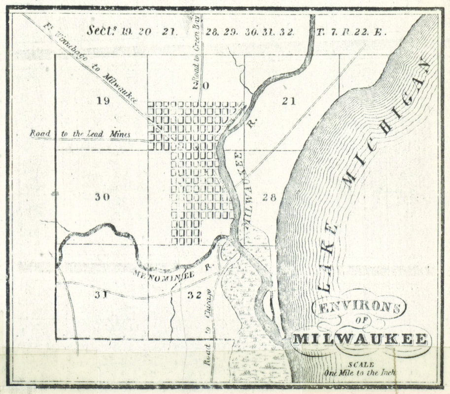
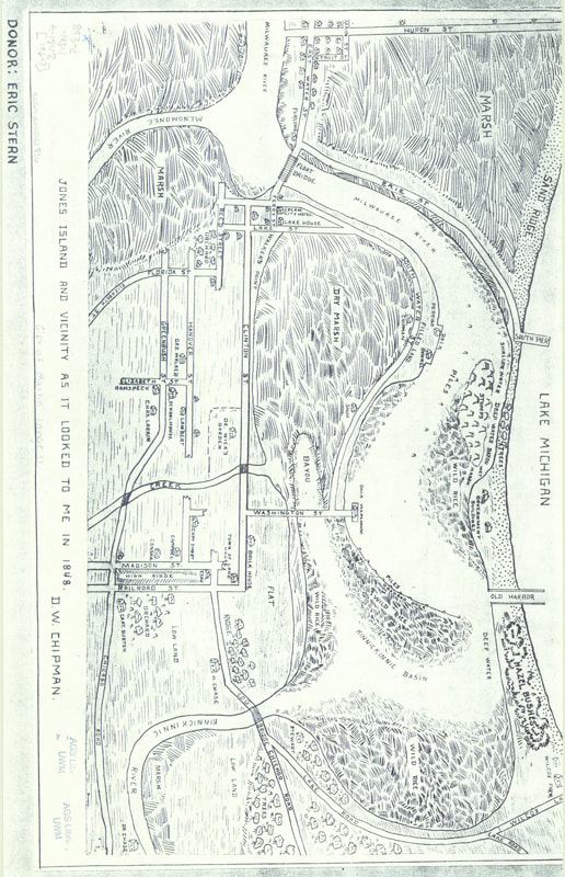
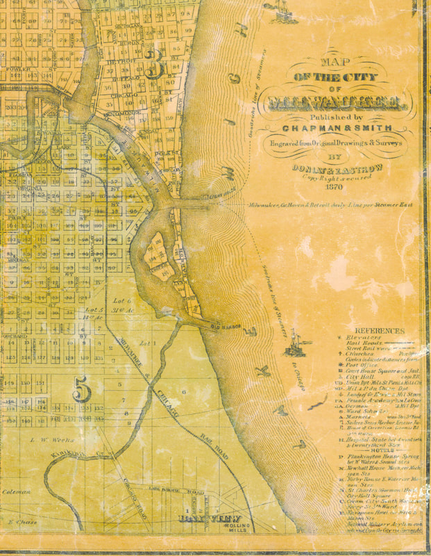
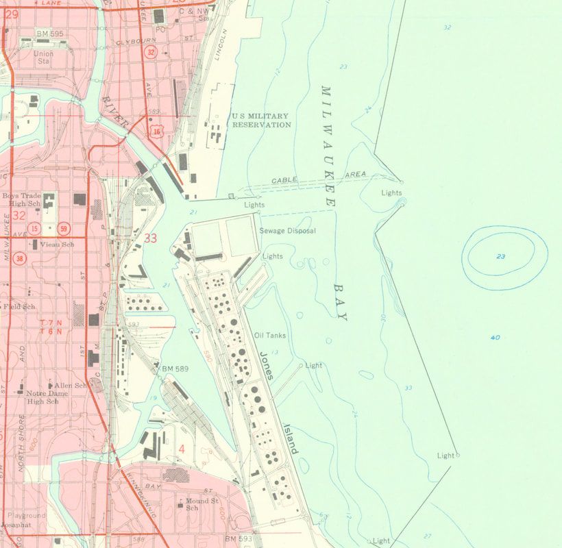
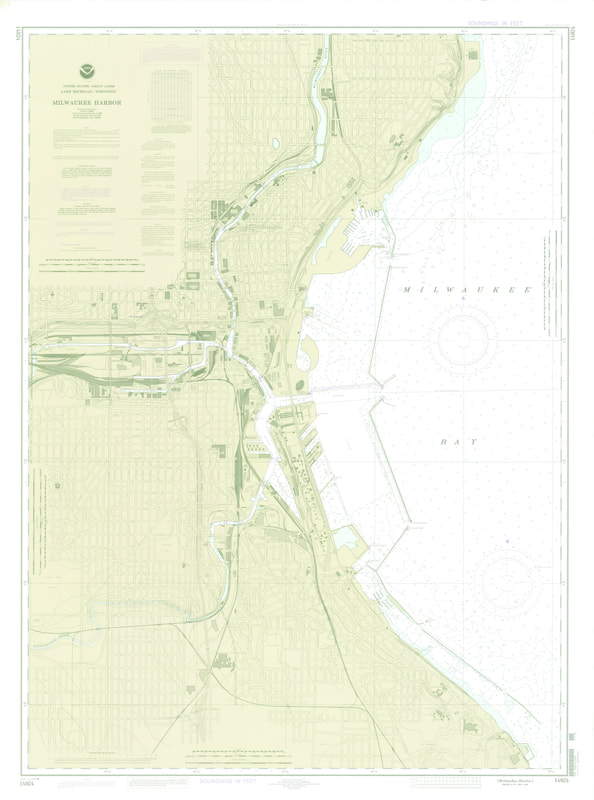
Milwaukee's Inner Harbor Neighborhood (just south of Downtown Milwaukee), located immediately on the Kinnickinnic River and close to Lake Michigan, was a marshland that contained wild rice and a squatter community. The wild rice is native to the region and was maintained by the squatter community until the 1900s. After 1900, the Kinnickinnic River was dredged and the neighborhood transformed into an industrial hot spot (See historic maps of Milwaukee). The convergence of the Kinnickinnic River and Lake Michigan made this area easy to access for exportation and importation of goods and materials including coal. The marshlands native to this area were filled to allow for this change in land use, all of which allowed for growth of industry in this neighborhood. The inner harbor today remains a major shipping port that boosts Milwaukee's economy but, the long industrial use of this area has left the neighborhood with over 90 separate brownfields (Davis, Sauer & Yoder, 2011). The most critical of these brownfields lies at the heart of what was the wild rice lands, the old site for the Solvay Coke and Gas Company. Milwaukee's Inner Harbor Neighborhood
Although land use has changed over time, this area has provided humans with services for over a century making it fundamental to the neighborhood and the city of Milwaukee. The native ecology of this land has been lost and given the proximity of the area to major waterways in the city, the health of this neighborhood is key in the health of the Kinnickinnic River and the Great Lakes. In Milwaukee's Inner Harbor, human industry has limited access to clean land for the surrounding residents and has created a series of unhealthy places to be.
|
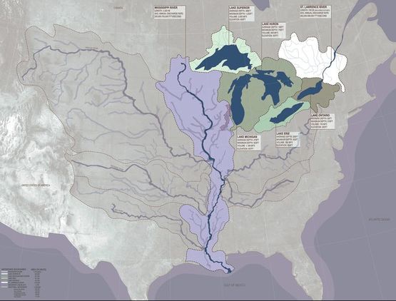
Large scale waterways and their corresponding drainage basins in the Midwestern United States (Focus Area Highlighted in Dark Lavender)
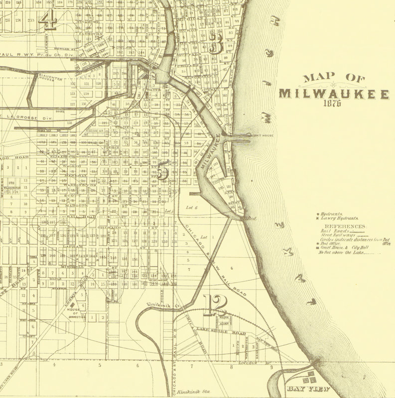
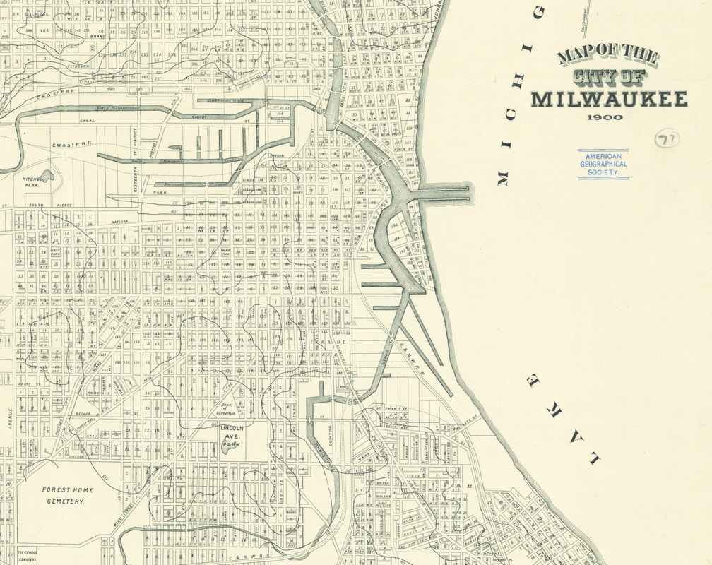
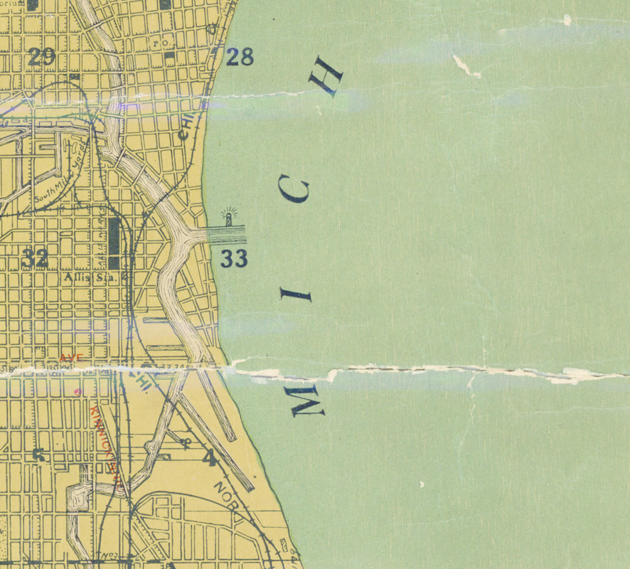
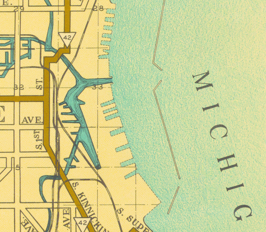
Historic Maps of Milwaukee's Inner Harbor from 1836-1984
|
Solvay Coke and Gas Company
Of the many materials imported into Milwaukee's Inner Harbor, the coal shipped to the Solvay Coke and Gas Company has had an enormous impact on the health of the land. While this site is just one of many contaminated land sites in Milwaukee, the condition of the land due to human industry, proximity to Lake Michigan and relative closeness to a residential area makes this site particularly interesting.
Coal in the U.S. comes from several places but the top 5 exporters are Wyoming, West Virginia, Kentucky, Pennsylvania and Illinois. Once the coal arrived at the Solvay Coke and Gas Company, it was stored closest to the river's edge and across from what is now the University of Wisconsin-Milwaukee's School of Freshwater Sciences. The coal on this site was used to produce Coke for steel production. This process is highly destructive to the environment as well as the health of a region but provided the city with a large economic boost and local residents with work (EPA, 2017) . The human industrial use of this site has left a highly toxic riverside piece of land that must seek remediation in order for human activities to take place on it. This site along with many others in this neighborhood, exemplify the importance of access to clean land. Its large size and proximity to a residential neighborhood make this site ideal for public green space use but given the high levels of contamination from human industry, the opportunity is lost. |
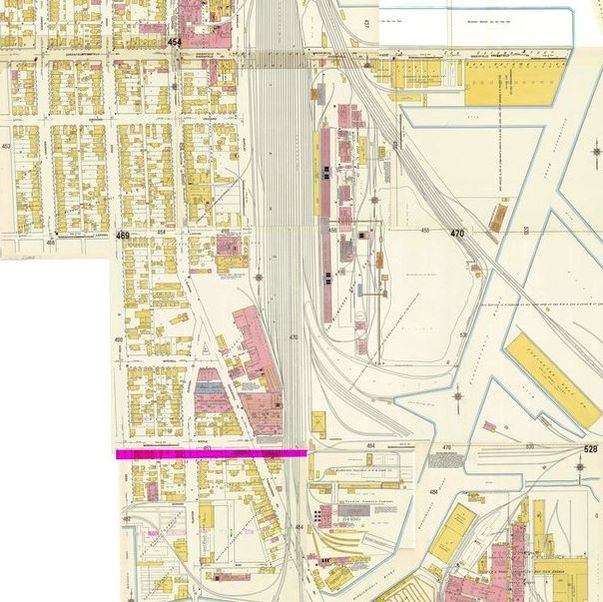
Solvay Coke and Gas Company Sanborn Map, 1910
|
Site Contamination and Remediation
The Solvay Coke and Gas Company site currently contains many hazardous contaminants that must be removed prior to human habitation on the land. The most imperative contaminants to remove include hydrocarbons, coal, coal tar, benzene and tar acid (Budiarto, 2001). While many places around the city of Milwaukee have contaminated soil, the extent of human damage on this site as well as the proximity to a residential neighborhood and a major waterway make this site a pressing issue for the city. The EPA has declared this site a Superfund site and initial cleanup measures have been taken (EPA, 2017).
This specific area of Milwaukee contains a high concentration of contaminated sites due to its industrial history (WDNR). This has limited the amount of clean land available for green spaces in this neighborhood. In just a ten minute walking distance from a centrally located residential block, there are fourteen open cases of contaminated and hazardous sites (See Diagram: Contaminated Sites Within Study Boundary). Given the limited amount of space available for green space, the remediation and clean up of hazardous sites, is the only option to provide this neighborhood with healthy places to be. The remediation process can be long but can also provide an educational opportunity for the residents as well as the city as a whole. In the case of Milwaukee's Inner Harbor Neighborhood, the time required to remediate land is directly related to a human lifecycle. Because of this, the remediation process should not be hidden from the public but celebrated through local interaction. |
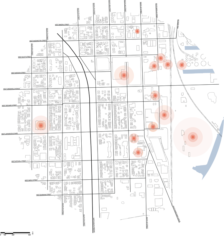
Contaminated Sites Within Study Boundary (RR Site Maps, WDNR)
|
Determining Appropriate Places for Green Space Intervention
Residential blocks of city neighborhoods are useful in identifying different age demographics in cities. For the purposes of this study, one residential block of the Inner Harbor Area has been chosen for analysis for that very reason. In addition to age demographic information, this block was chosen due to the proximity of it to other contaminated sites in this neighborhood and specifically, its proximity to the old Solvay Coke and Gas Company Site. A residential block was also chosen for analysis to identify the common age groups present in this area and the age groups that would benefit the most from the implementation of green space.
The existing conditions surrounding this block also made it a clear choice for study since within a fifteen minute walking range, there are only four public green spaces on healthy land. This means that there are three and a half times more contaminated sites than green spaces in this area for public use. By using this residential block, access to green space by different age groups in this neighborhood can be visualized. Also, the locations of appropriate green space interventions may be identified based on the needs of the residents. |
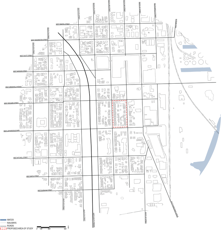
Proposed Study Area
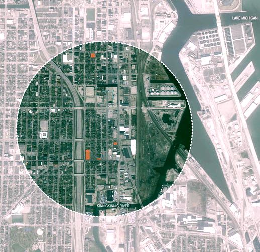
Existing Public Green Spaces (Identified in Orange)
|
References:
- Alexander, Christopher, Sara Ishikawa, Murray Silverstein, Max Jacobson, Ingrid Fiksdahl-King, and Angel Shlomo. A Pattern Language: Towns, Buildings, Construction. New York: Oxford University Press, 1977.
- Budiarto, Florence. Cost Assessment for Remediation/ Redevelopment of a Former Manufactured Gas Plant Site. Milwaukee School of Engineering, 2001.
- Fleuret, Sebastien, and Sarah Atkinson. "Wellbeing, Health and Geography: A Critical Review and Research Agenda." New Zealand Geographer 63, no. 2 (2007): 106-18. doi:10.1111/j.1745-7939.2007.00093.x.
- Davis, Jeremy, Mark Sauer, and Devin Yoder. Industrial waterfront redevelopment Milwaukee’s Inner Harbor urban design and redevelopment strategies. Urban Planning Studio, University of Wisconsin-Milwaukee, 2011.
- “SOLVAY COKE AND GAS COMPANY Site Profile.” EPA, Environmental Protection Agency, Accessed May 16, 2018. 20 Oct. 2017, https://cumulis.epa.gov/supercpad/cursites/csitinfo.cfm?id=0508215
